
Photo Credits: Liam H. Flake
Letter of Recommendation: Fort Collins Natural Area Map
I’ve always had an affinity for maps. Not quite Apple Maps or Google Street View, per se, but paper maps, folded and crisp in my hands. There’s simply something appealing to the notion of poring over a place, a city or region, holistically.
The lobby of Council Tree Library is itself a relatively unconsidered location. With a shelf of pamphlets, a smattering of furniture, and a table of bus schedules, it serves as little more than a necessary intermediate zone between the books and the outside, a sort of library no-man’s-land.
The plastic shelves host a cluttered assortment of city-sponsored literature – information on local programs, coupon books, and other offerings. From time to time, I’ll rifle through the array presented and check for anything that piques my interest, any potentially relevant information to my life. It was in this ritual that I uncovered, nestled amongst the bits and pieces, a stack of thick folded pamphlets labeled in simple capital letters: CITY OF FORT COLLINS NATURAL AREA MAP.
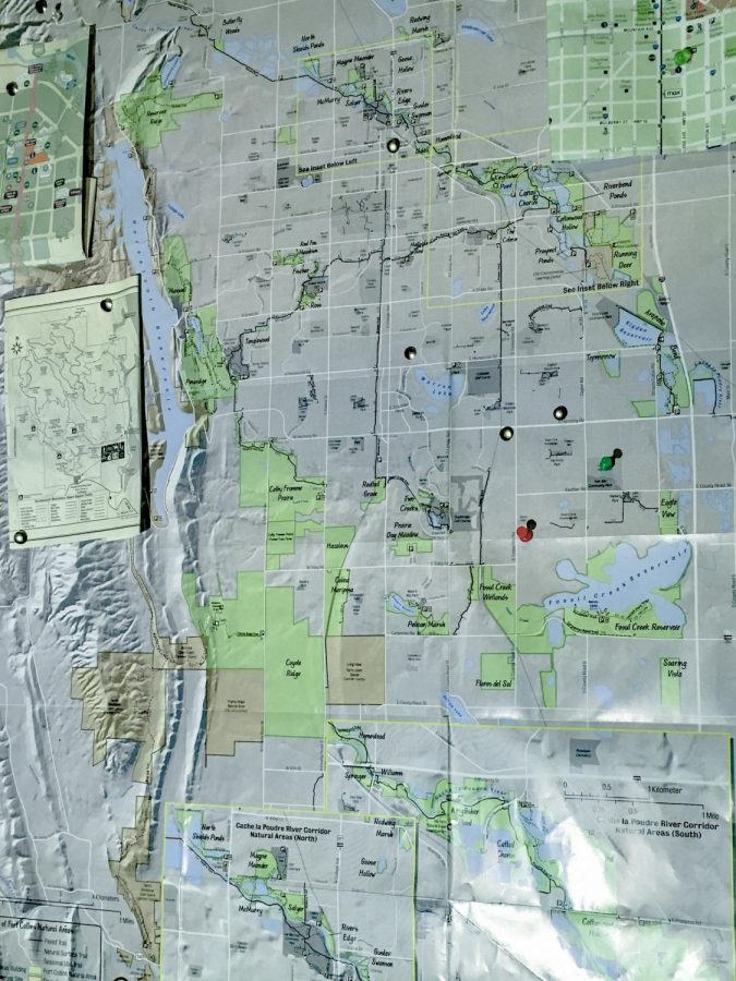
Fort Collins hosts over 36,000 acres of preserved space, divided into 49 natural areas dispersed intermittently throughout the city. These areas are home to abundant wildlife and offer more than 100 miles of trails to Fort Collins citizens, varying greatly in size and habitat.
Take for example, Arapaho Bend, located at the end of Horsetooth Road and Strauss Cabin Road, which offers a riparian environment along the Poudre River that hosts fauna from herons to beavers. Or there’s The Coterie, a small meadow at the intersection of Timberline Road and Prospect Road, which is overrun with small white flowers and an massive number of prairie dogs.
The Fort Collins Natural Area Map documents these spaces in a simple and understandable format: grey for the city itself, and green for the wilderness within it. It outlines trails, picnic areas, restrooms, and even marks historical landmarks hidden within the natural areas, like the White Mountain Fire Lookout.
The natural area map is the people’s key to the nature within our city. With it, Fort Collins citizens are able to access the undeveloped haven from suburbia found, not miles into the mountains, but in our backyards.
The beauties of the natural world and refuge from the cacophony of the city are not beyond the grasp of everyday life; they are available to all who know where to find it.
After all, as the maps proclaim, Fort Collins natural areas are yours to explore.